Free to Download,
$0.90
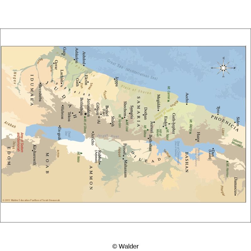
To Print For You.Map of Israel and Surrounding Countries From Biblical Times (Nach)
Item Number: HOJEW13-RL001
A map Of Israel and surrounding countries from Biblical Times. Possible Uses: An excellent visual teaching tool when used as part of an existing Jewish History or Tanach curriculum. Students will gain a better understanding of Jewish History from this visual aid.
No reviews yet.
-
HOJEW13-RL001 163 Downloads
Or Print For Me:
$0.90
Specifications
| Size: | 8.5×11 |
| Language: | English |
| Language Style: | N/A |
| Gender: | N/A |
| Color: | Black and White |
| Grade(s): | 6th-8th Grade High School Post High School |
| Resource Type(s): | Handouts |
| Subject(s): | Israel Israel |
Printing
Creditst
Creditst
| Contents: | 1-8.5×11-Color | Paper | Not Laminated |
|---|---|---|---|
| Page Scaling: | Fit to Printable Area | ||
| Notes: | Some cutting and assembly may be required. Laminated items will require trimming. Items larger than 11×17 inches may require a large format printer. |
||
Credits
| Publisher: | Walder Education |
| Founding Director: | Mrs. Rouhama Garelick |
Date Submitted: May 9, 2014
Reviews
Be the first to review “Map of Israel and Surrounding Countries From Biblical Times (Nach)” Cancel reply
You must be logged in to post a review.


Reviews
There are no reviews yet.